

CHCI Members receive ‘NEH Digital Projects for the Public’ award
March 20, 2023
An interdisciplinary team with multiple CHCI members has been awarded $98,500 for a prototyping project by the National Endowment for the Humanities (NEH) program on Digital Projects for the Public.
The Digital Projects for the Public program supports projects that interpret and analyze humanities content in primarily digital platforms and formats, such as websites, mobile applications and tours, interactive touch screens and kiosks, games, and virtual environments.
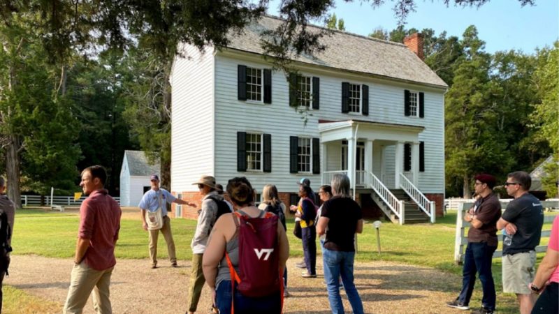
Project title: "Experiencing Civil War History Through Augmented Reality: Soldiers, Civilians, and the Environment at Pamplin Historical Park."

PI: Paul Quigley (VT, History)
Co-PIs: Doug Bowman (VT CS), Zach Duer (VT SOVA), Corinne Guimont (VT Libraries), David Hicks (VT SOE), Kurt Luther (VT CS), Todd Ogle (VT Libraries), Kathryn Shively (VCU History), Thomas Tucker (VT SOVA).
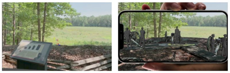
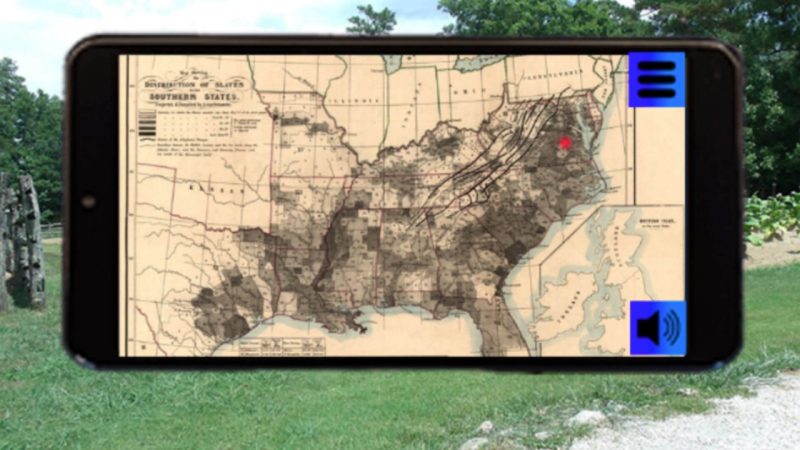
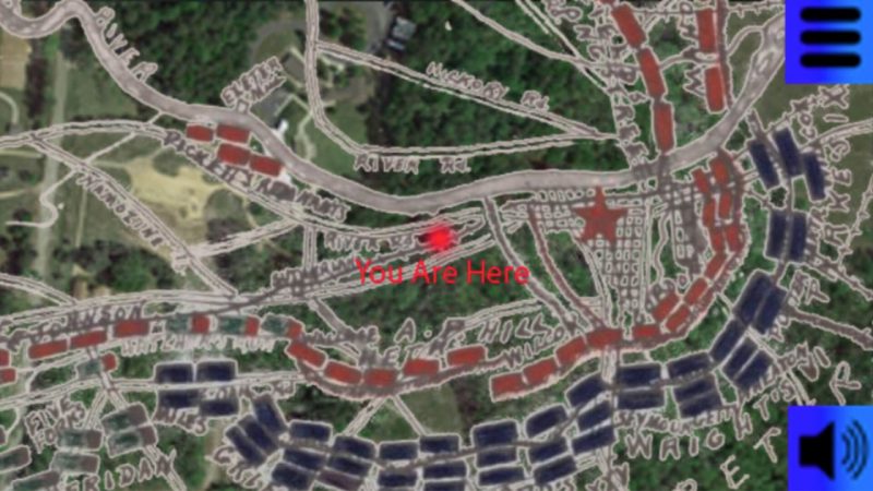
Project description: We are creating a prototype of an Augmented Reality application for visitors to Pamplin Historical Park in Petersburg, Virginia. Using mobile devices, visitors will learn about less familiar Civil War era topics: interconnections between the environment and military affairs; the war’s transformative impact on African Americans and civilians; and the benefits of reading both wartime documents and material artifacts with a historian’s eye. They will experience multimedia guided interpretations of historical documents and artifacts, view videos of historians sharing diverse perspectives, see visualizations of how slavery and war affected the landscape, and more. The prototyping grant builds on the "discovery" level grant our team received in 2021-22.
Related Content
-
General Item
-
General Item


.jpg.transform/m-medium/image.jpg)